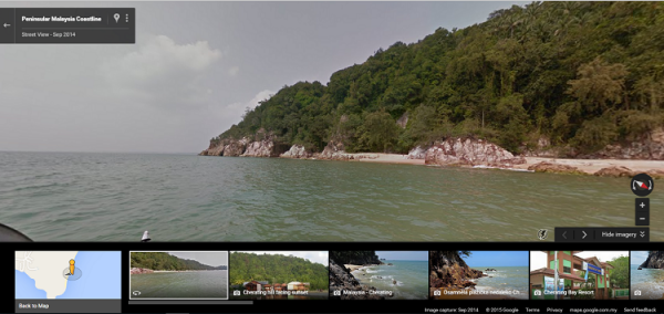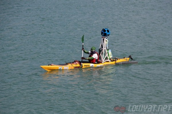
Images of the coast line of Peninsula Malaysia have been added to Google Street View, allowing people to kayak across the country without having to leave the comfort of their own homes. The images were collected in conjunction with the Malaysian Nature Society’s (MNS) “Paddle for Nature” campaign, which aimed to raise funds for the non-profit organisation.
Google and MNS spent six months collecting imagery from the coastal areas of peninsula Malaysia using a specially designed rig that attached the Street View camera to the back of a kayak. This was the first time Google used a kayak for Street View imagery, and the build has also been adopted by Mountain View for capturing Street View images of the San Francisco Bay.

The project had originally completed taking pictures back in March, but it has taken Google this long to stitch the images together and upload them to the Street View website. The images have also been used to assist in mangrove forest conservation efforts, and are included in reports by the MNS to the Forestry Department.
Those interested in taking a look at the coastal Street View for themselves can easily access it through Google Maps.
Follow us on Instagram, Facebook, Twitter or Telegram for more updates and breaking news.


